Routes · Gwanghwamun & the palaces, Jongno-gu
The Puppy Run.
강아지런 · 광화문
A loop through the historic heart of Seoul that draws a puppy on the map. Gwanghwamun Square, Gyeongbokgung, the Blue House, the palace-wall lanes and the Cheonggyecheon, all in one run.
- Distance
- 8.7 km
- Elevation
- 36 m
- Difficulty
- Easy
Course map
The route, on the actual map.
GPS-recorded track with points of interest along the way. Click any marker for the local context: water, toilets, CV stores, bridge crossings, photo spots.
- Distance
- —
- Elevation gain
- —
- High / low
- —
Loading map…
Hover the route or the elevation chart
- Distance
- —
- Elevation
- —
- Grade
- —
Restrooms, water fountains, and convenience stores near the route come from official Korean public open data (Seoul Open Data Plaza and data.go.kr). Hours can change, so treat them as a guide.
8.7 km +36 m Easy
How it runs
The route, in five parts.
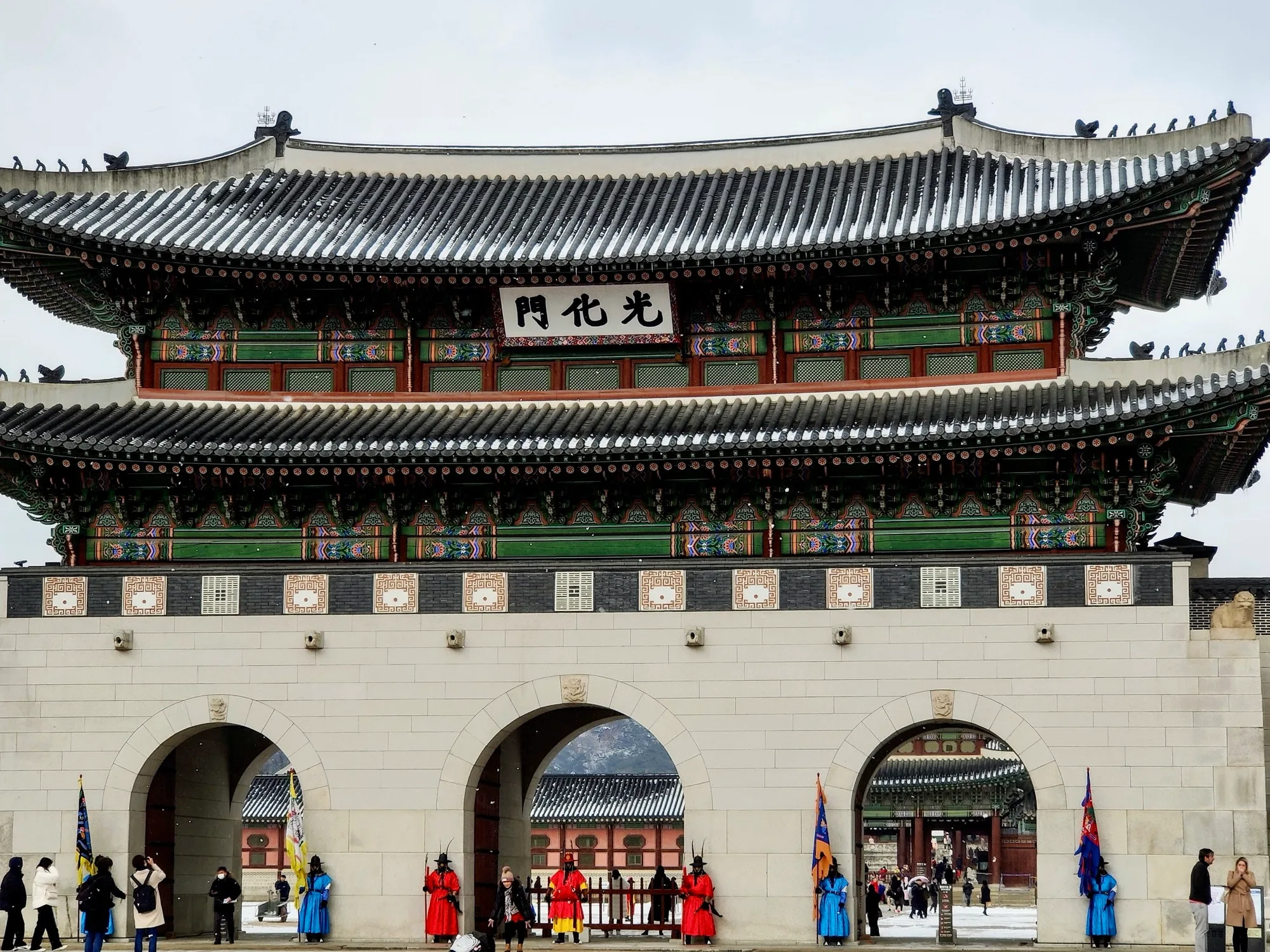
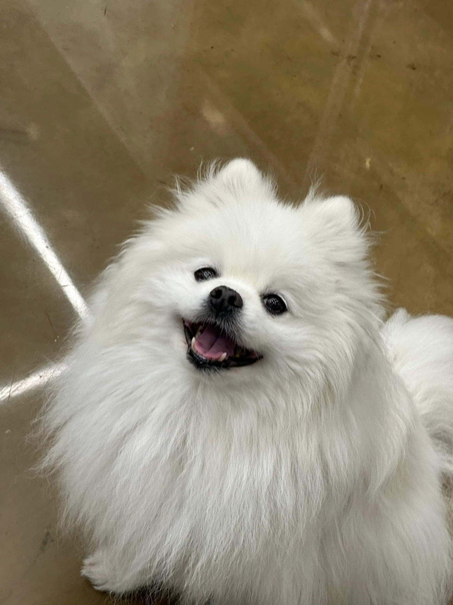
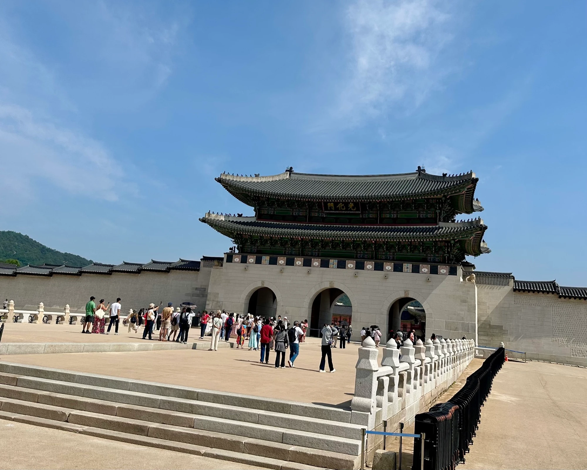
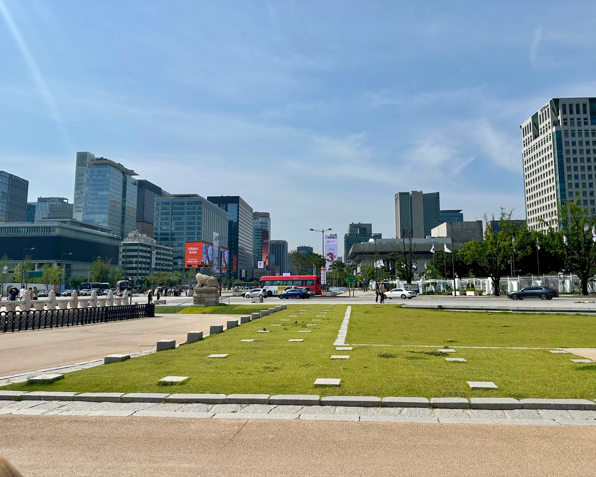
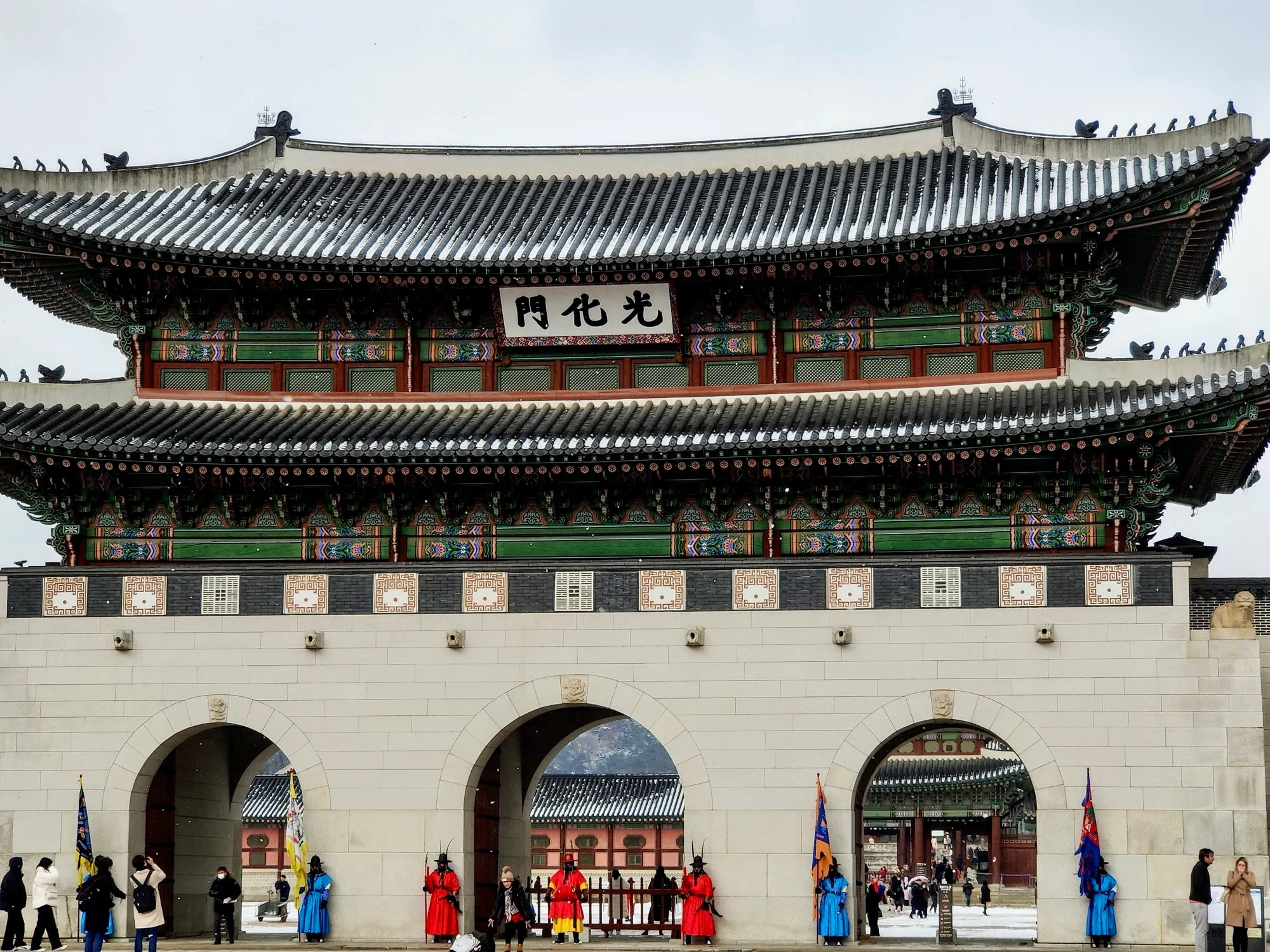
If there is one thing I love more than running, it is dogs. This is my puppy, so a route that combines the two is, to me, the best one yet, and beyond drawing a genuinely cute puppy on the map it has a lot to offer: Gwanghwamun Square, the Blue House, Insadong, the Cheonggyecheon. My favourite place in Seoul is on it, the entrance to Gyeongbokgung. Stand at the gate and one side is the traditional palace, tiled roofs and the mountain behind it; the other is modern Seoul, skyscrapers and screens and crowds streaming past. Like someone set Times Square next to a five-hundred-year-old palace, and somehow it works.
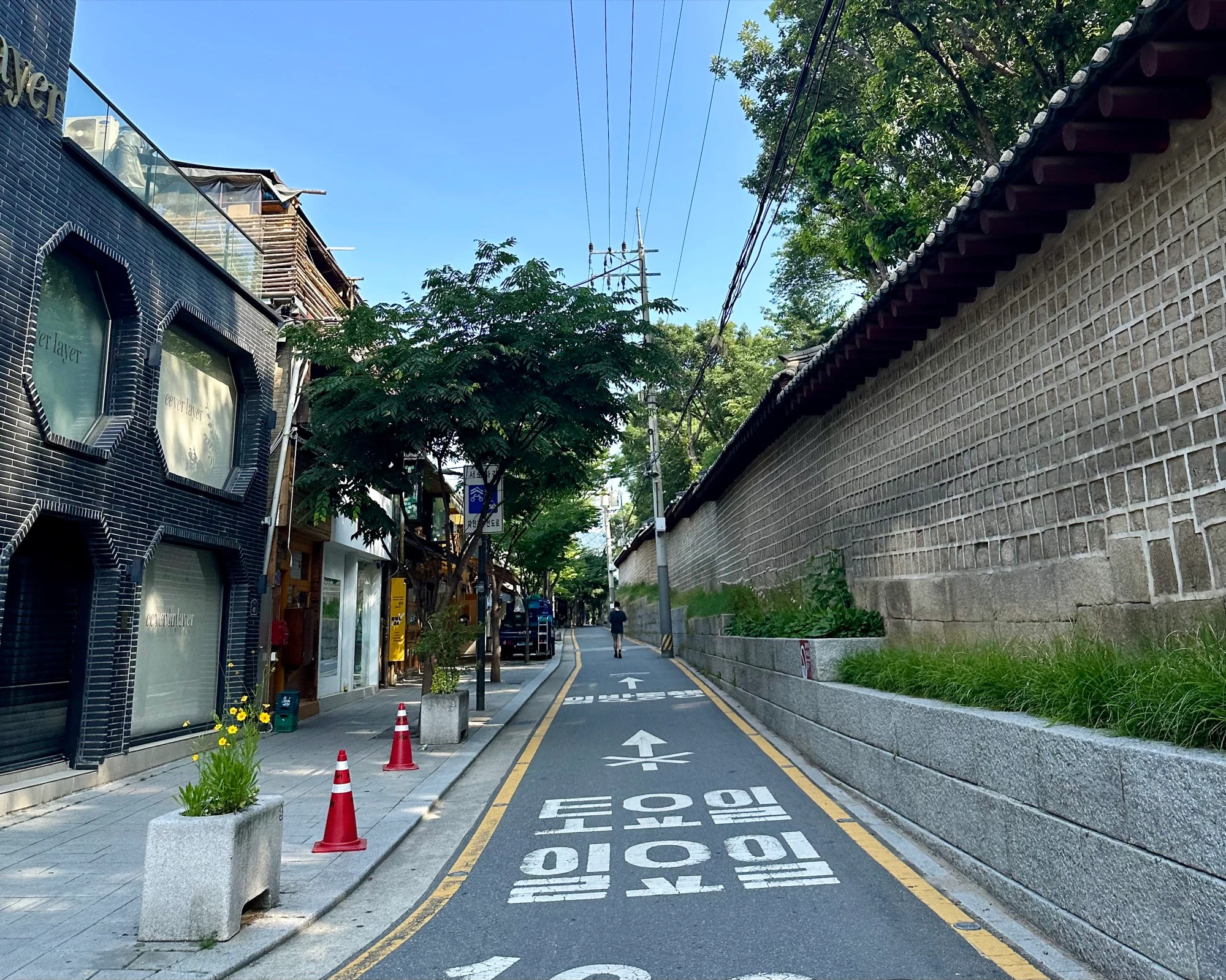
From there you head down toward the Cheonggyecheon, the stream through the centre of the city. For decades it was buried under an elevated highway; the city tore the road down and daylighted it in 2005, and now it is a sunken, traffic-free walkway through downtown. You thread the narrow lanes of Bukchon and Insadong, run the quiet roads along the old palace walls, and pass the Blue House, the former presidential residence. The loop stays mostly above the Cheonggyecheon, but you can add a stretch along the water at the end for extra distance.
- 01
Gwanghwamun Square and the gate
We start near Gwanghwamun and head up the square toward Gyeongbokgung. The spot I love most: at the palace gate the traditional and modern city sit right next to each other, tiled roofs and Bugaksan on one side, skyscrapers and screens on the other.
- 02
Around the palace to the Blue House
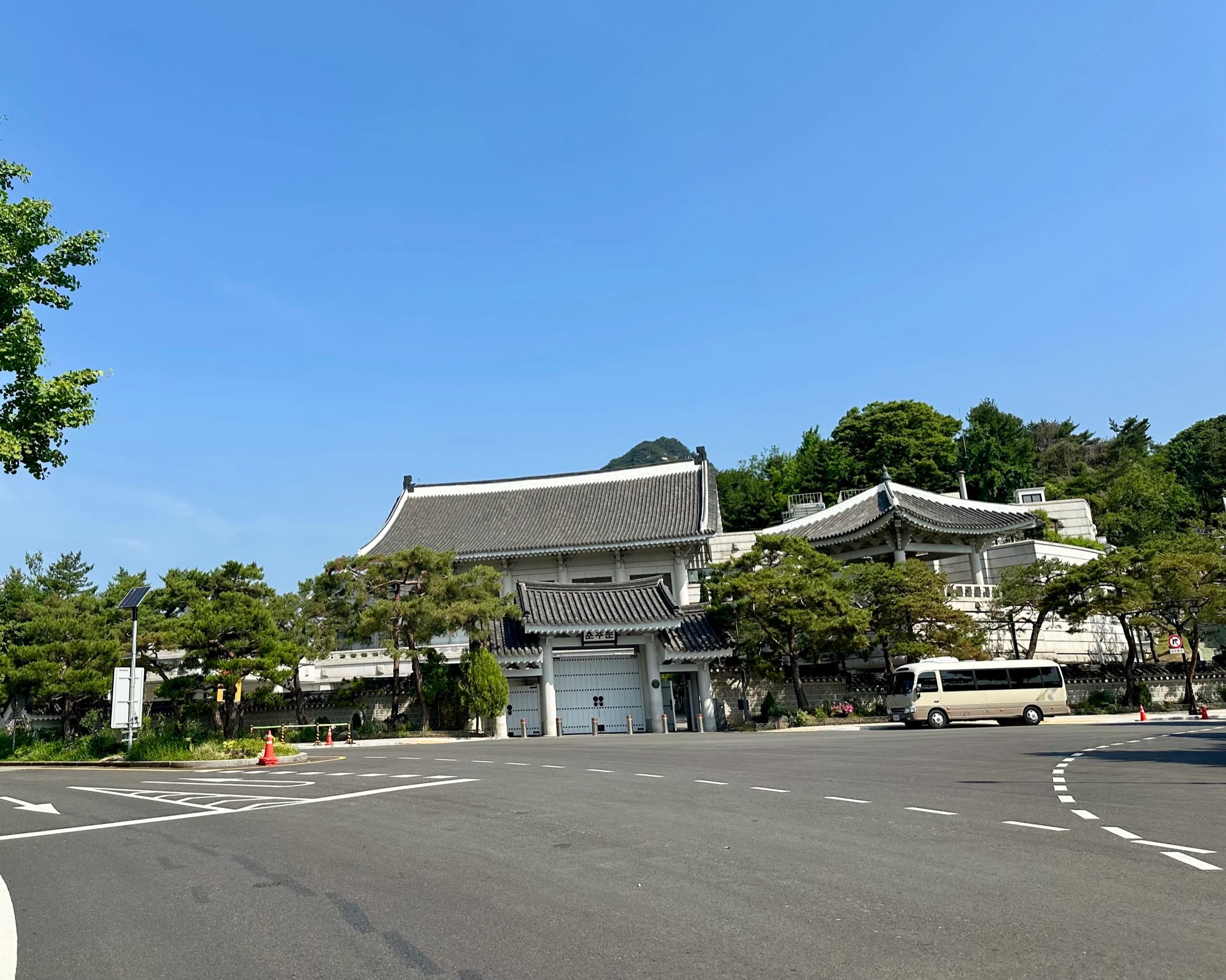
Quiet roads along the palace walls up to the Blue House, the former presidential residence, under the forested mountain. Calmer than the square, with the fountain plaza and the Museum of Craft Art on the way.
- 03
The palace-wall lanes of Bukchon and Insadong
Down through the narrow lanes east of the palace, stone walls on one side, cafes and galleries on the other. The prettiest running in central Seoul, the part that surprises people who only know the big avenues.
- 04
Through the heart of the city
Back toward the centre past Bosingak and the Cheonggyecheon, the daylighted stream below street level through downtown. The loop keeps you mostly above it, but you can drop down and add a stretch along the water at the end.
- 05
Close the loop, and the puppy
Back to the start, having traced a puppy across the middle of Seoul. About 8.7 km, flat the whole way. The only real challenge is the crowds, not the climbing, which is why I run it early.
Facts
Numbers, surfaces, fountains, toilets.
The things you actually want to know before you head out.
- Default distance
- 8.7 km loop
- The shape
- Traced on a map, the route draws a puppy. It is GPS art.
- Elevation gain
- Flat and gentle through the city centre
- Surface
- City pavement and palace-wall lanes; optional Cheonggyecheon stream path
- Landmarks
- Gwanghwamun Square, Gyeongbokgung gate, the Blue House, Bukchon & Insadong lanes, Bosingak, the Cheonggyecheon
- Shoe rental
- A running store on the route rents shoes; you also pass Korea’s first Salomon flagship trail store
- Traffic exposure
- A real city route: road crossings, lights and busy pavements, not an uninterrupted park run.
- Toilets
- Jonggak Station plus public facilities around the square and palace
- Convenience stores
- Many through the city centre
- Transit
- Gwanghwamun (Line 5), Gyeongbokgung (Line 3) and Jonggak (Line 1) all sit on the loop
When to run it
Best time, best season, the honest caveats.
Best time of day
Early morning, without question. The whole point of running this route is the quiet light on the palace and the empty square before the city centre fills up. Run it at dawn and it is yours.
Best seasons
Spring and autumn are loveliest around the palaces, but this is a four-season route. The gate and walls under fresh snow in winter are worth a cold early start, and the city-centre paving stays runnable when the riverside routes get slick.
Caveats and Plan B
- This route runs through crowded city streets, so run it early morning. Midday and evenings, especially weekends, get busy. Late evening is feasible too, just take it slow.
- A city route, not a park: expect road crossings, traffic lights and pavement shared with pedestrians. Pace it accordingly.
- Access to the Blue House grounds has changed back and forth; we run past it regardless, but whether you can go in depends on current rules.
From me
I love dogs more than just about anything except maybe running, so a route that lets me do both, even if the dog is only a shape on a map, was always going to be a favourite. But it earns its place on its own: nowhere else in Seoul lets you run past a five-hundred-year-old palace gate, a forested presidential residence, and a daylighted downtown stream inside a single easy hour.
· Quintin
Where we start
Gwanghwamun, by the south end of Gwanghwamun Square
Subway Line 5, Gwanghwamun (Exit 1–4 put you on the square). Gyeongbokgung (Line 3) and Jonggak (Line 1) also sit on the loop if they are easier for you.
FAQ
Quick answers.
-
Do you really draw a puppy?
You do. The loop is GPS art: traced on a map it draws a dog. The shape is the fun part, but the run stands on its own through the historic centre of Seoul.
-
When should I run it?
Early morning. This goes through the busiest part of the city, and at dawn it is calm, cool and yours. Midday and weekend evenings are crowded; late evening works if you take it slow.
-
I did not bring running shoes.
A running store on the route rents shoes, so you can still run even if you flew in without yours. You also pass the first Salomon flagship trail-running store in Korea on the way.
-
Can we make it longer?
Yes. The loop stays mostly above the Cheonggyecheon, but we can drop down and add a stretch along the stream itself at the end for more city views and extra distance.
Take it with you
GPX + interactive map coming with the full runner's guide.
Downloadable GPX, turn-by-turn cues, the elevation profile, and an interactive map land with the full guide. Until then, run it with me, I know every turn.
More Seoul routes
Where to run next.
Yeouido Goguma Loop
A flat lap of Yeouido island, named for the goguma (sweet potato) it draws on the map. Forested river paths, the 63 Building in gold, and the best-equipped runner hub in Seoul to start from.
- 8.6 km
- Easy
- ~50 min main loop
Mangwon · Han River · Seonyudo
My home-ground route. Start in the city, jump into complete greenery, cross two bridges and end up on a hidden island park most Seoulites have never visited.
- 12.3 km
- Easy
- ~1:15 main loop
Namsan Mountain
A real Seoul hill run. A 3.5 km foot-traffic-only loop of up-and-down hills under a closed tree canopy, and the option to keep climbing to N Seoul Tower for the view.
- 7.1 km
- Moderate
- ~55 min hill loop