Run With Me Seoul · the app
Sketch a line. The app turns it into a route on the paths runners use.
The route builder in the Run With Me Seoul app turns a line you draw on the map into a route you can actually run. It follows Seoul footpaths and riverside paths rather than roads, weighted toward the ones runners already take.
Free. iOS and Android.
- Your watch
- gets the route you drew, as GPX
- 0
- signal needed for the route, the turns and the taps
- Free
- with no account and no route limit
How the route builder works.
01
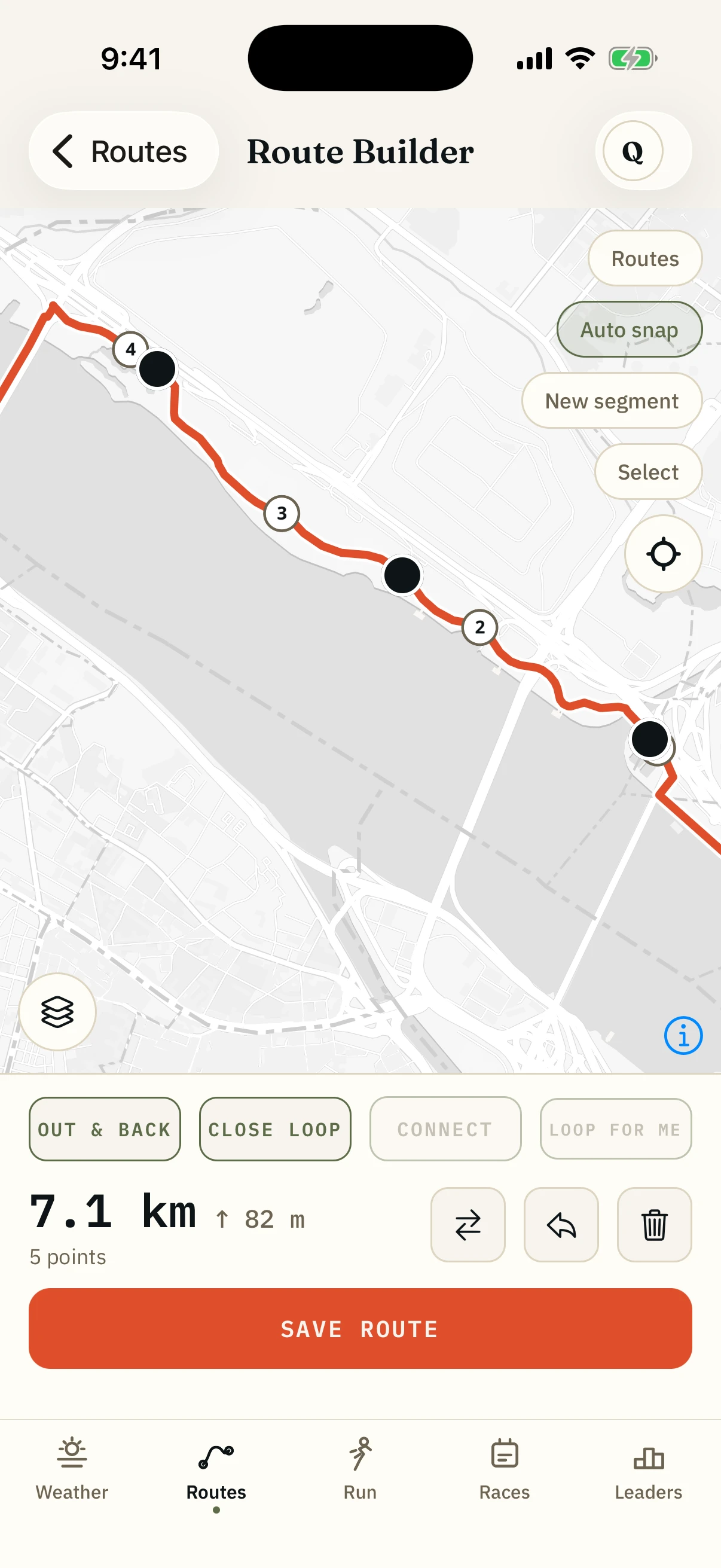
Tap out the shape you want.
Drop a start, then tap the big turns. The app fills in everything between them.
02
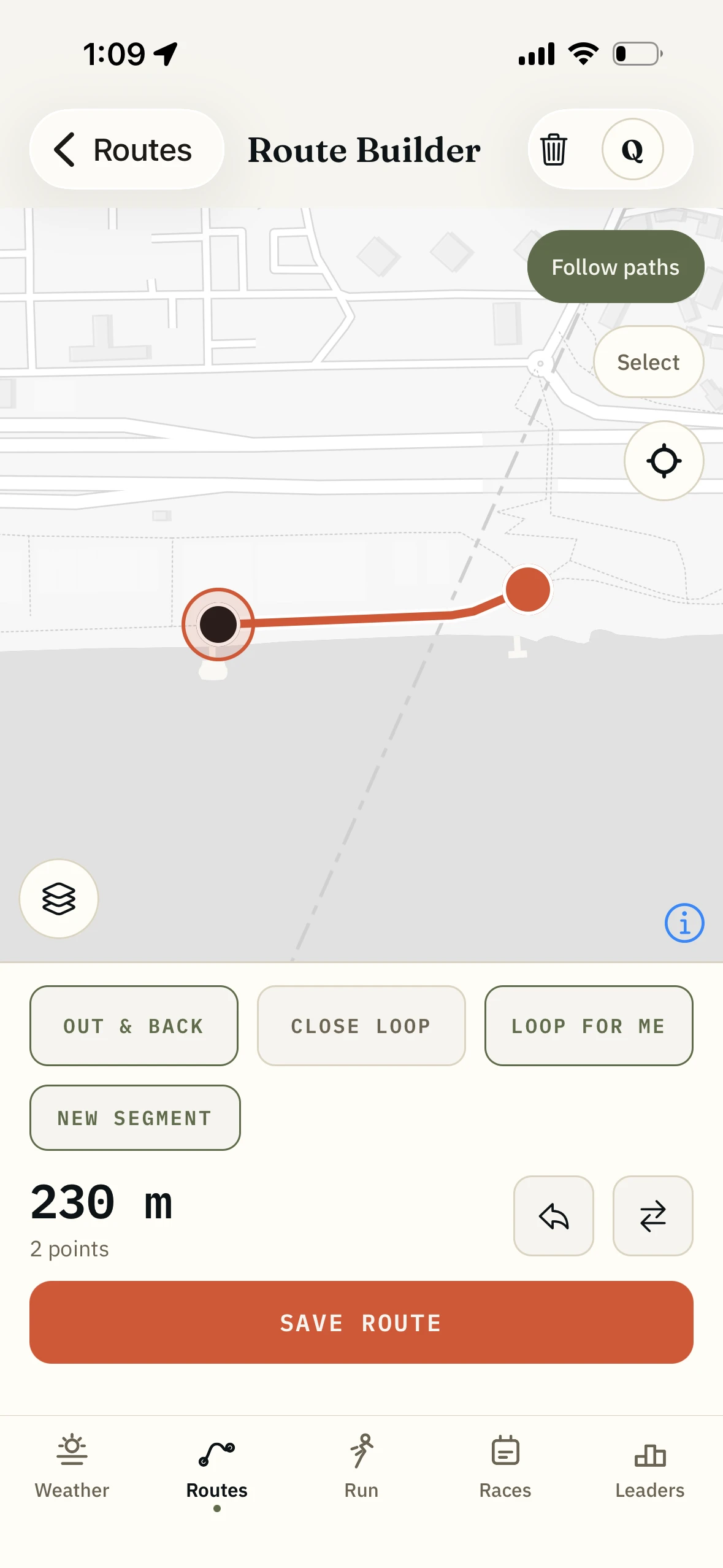
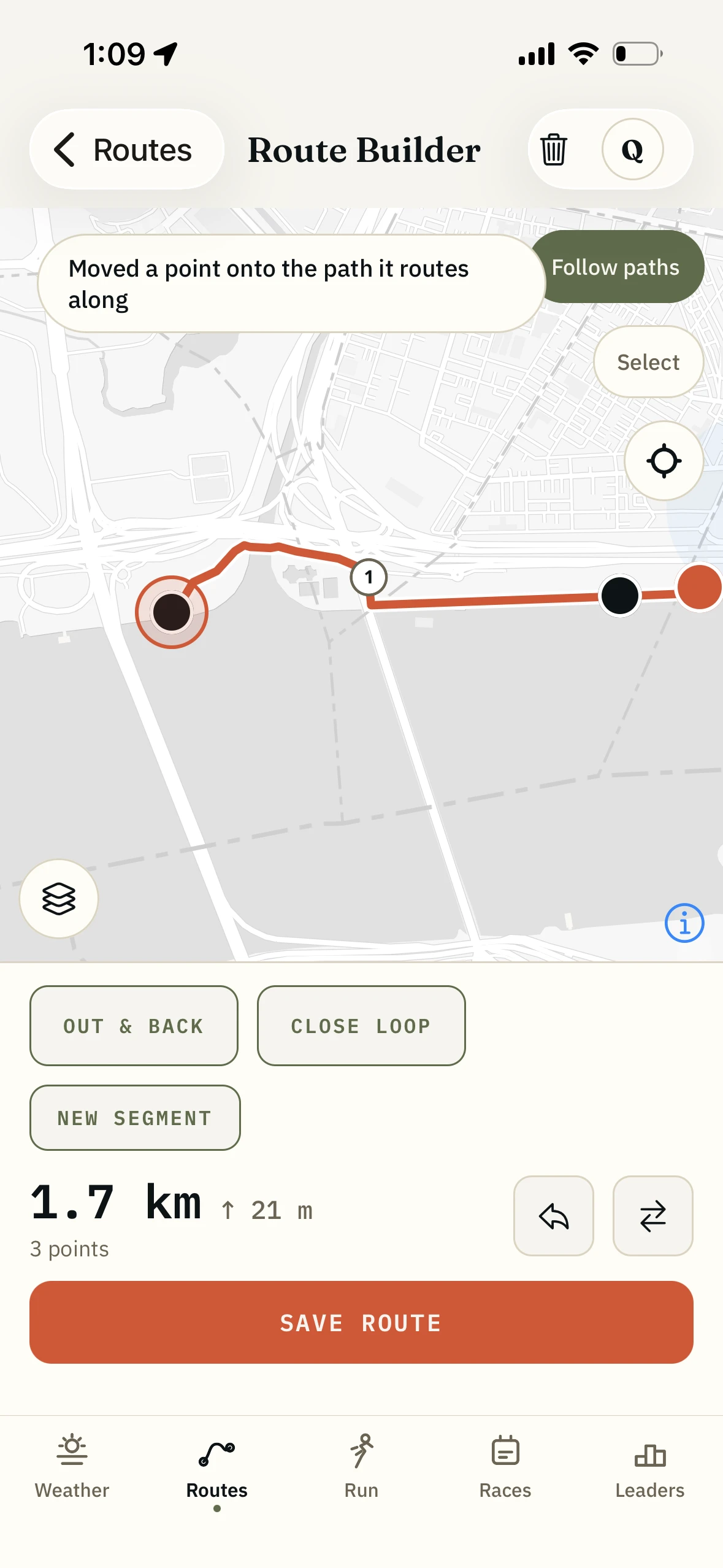
It snaps to the line runners actually take.
Between your taps it follows the footpaths and riverside paths real Seoul runs use over and over. Ask a map app for walking directions and it sends you through the city; ask a watch and you end up turning its snapping off and placing a hundred points by hand. This one draws the line a runner would.
03
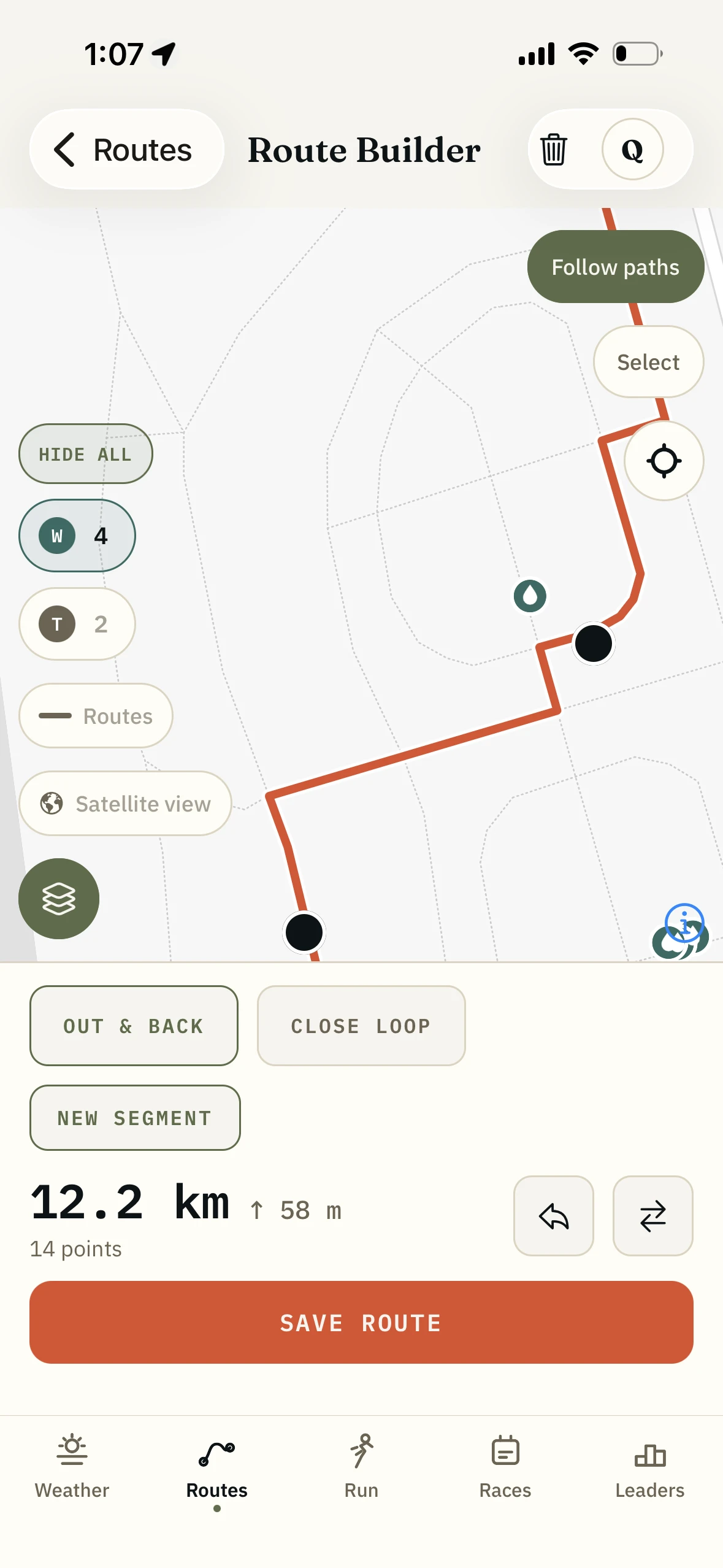
Drag any point until it is the run you meant.
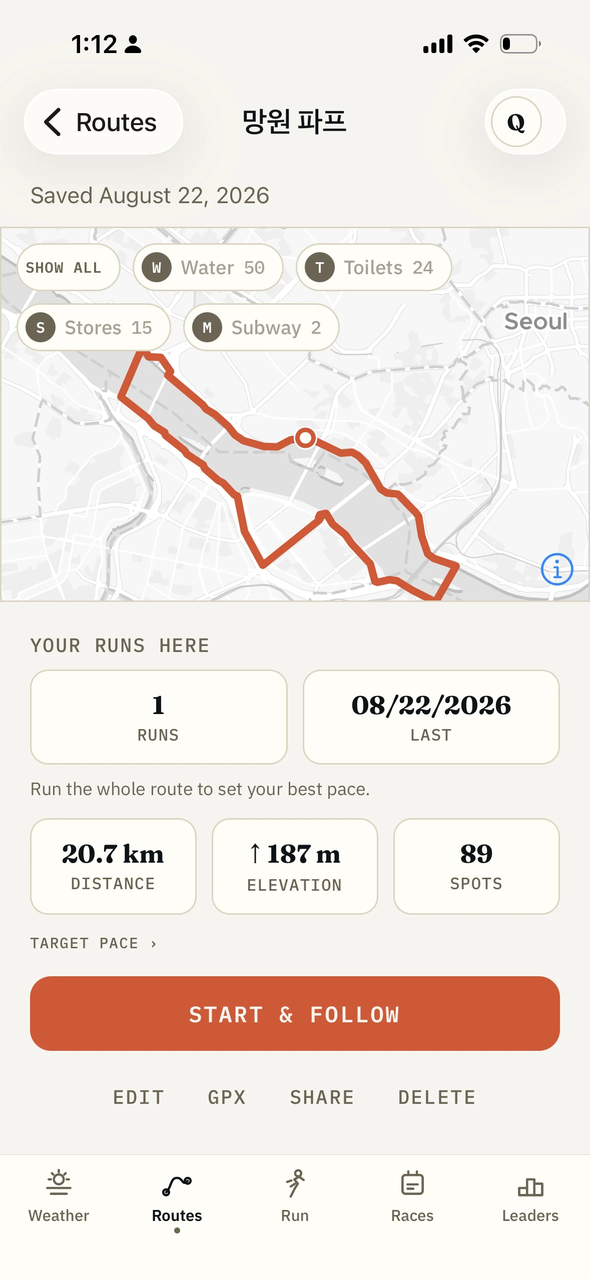
Move a point and the line re-routes, distance and elevation updating as you go. Taps, toilets and stores sit on the same map, so you can pull the line two hundred metres to pass a fountain at 15K.
04
Save it, run it, or send it to your watch.
A saved route guides you turn by turn with no signal, and the Seoul map pack keeps the tiles under it. Export GPX for Garmin, Strava or anything else you use.
What the builder routes on.
- What it routes on
- Footpaths, riverside paths, park paths and streets, from OpenStreetMap
- What weights it
- Segment frequency from real recorded Seoul runs
- While you draw
- Live distance and elevation profile
- On the line
- Water fountains, public toilets and convenience stores
- Editing
- Drag, insert or delete any point
- Turn-by-turn
- Yes, on a saved route
- Offline
- Route, turns and pins. Download the Seoul map pack once for the tiles under them
- Export
- GPX
- Price
- Free
- Account needed
- No, until you want it on a second device
Who it is for.
You moved to a new neighbourhood.
A 5K exists near your building and you have no idea what shape it is. Draw the shape; the app finds the paths.
You need an exact distance.
A session calls for 12K and you would rather not run 800m of laps around a block to make the number.
You are going long.
Thirty kilometres in August, and the run turns on where you can drink. Draw it past the fountains instead of hoping.
You already know the run in your head.
You have run it fifty times and want it on your watch without recording it first.
What it is not.
It is not a training plan.
It draws the route. It has no opinion about whether today is intervals.
It is not a curated route.
This is your line, not one of mine. The routes I ran and checked myself are in the app too.
It is not a trail-grade router.
Mountain trails around Seoul are mapped unevenly. On Bukhansan, trust your eyes over any drawn line, mine included.
How it fits with the rest of the app.
- Water, toilets and a CU on the map
The other half: the nearest tap or toilet once you are already out.
- Run tracking
Follow a route you built and it records the run against it.
- Curated Seoul routes
Start from a route somebody checked, then edit it into your own.
- The Korea race calendar
The August route is training for something in October.
Questions.
Do I need an account to build a route?
No. An account only matters when you want the route on a second device.
Does the route builder work outside Seoul?
It routes anywhere OpenStreetMap has paths. The runner-path weighting is Seoul, because that is where the recorded runs are.
Can I get the route onto my watch?
Yes. Export GPX and load it into Garmin Connect, Strava or whatever you use.
Will it follow the river path?
Yes, and that was the hard part. A map app gives you walking directions through the city; the weighting here pulls the line down onto the water, because that is where the recorded runs are.
Can I edit a route after I have run it?
Yes. Open it, drag a point, save. Runs recorded against the old shape stay put.
What happens when I lose signal under a bridge?
Nothing. The route, the turns and the pins are already on the phone. Download the Seoul map pack once for the tiles under them.
Draw the run you meant to do.
The route builder is in the app, free, on iOS and Android.
The rest of the app.
- Curated Seoul routes64 routes, offline, turn by turn
- Water, toilets and stores7,274 places on the map, no signal needed
- GPS run trackingRecords offline, follows your route, GPX in and out
- The running weather scoreOne number for whether to run right now
- Leaderboards and friendsWhole routes, not segments, among people you know
- The Korea race calendar400+ races, with an alarm before entries open