Run With Me Seoul · the app
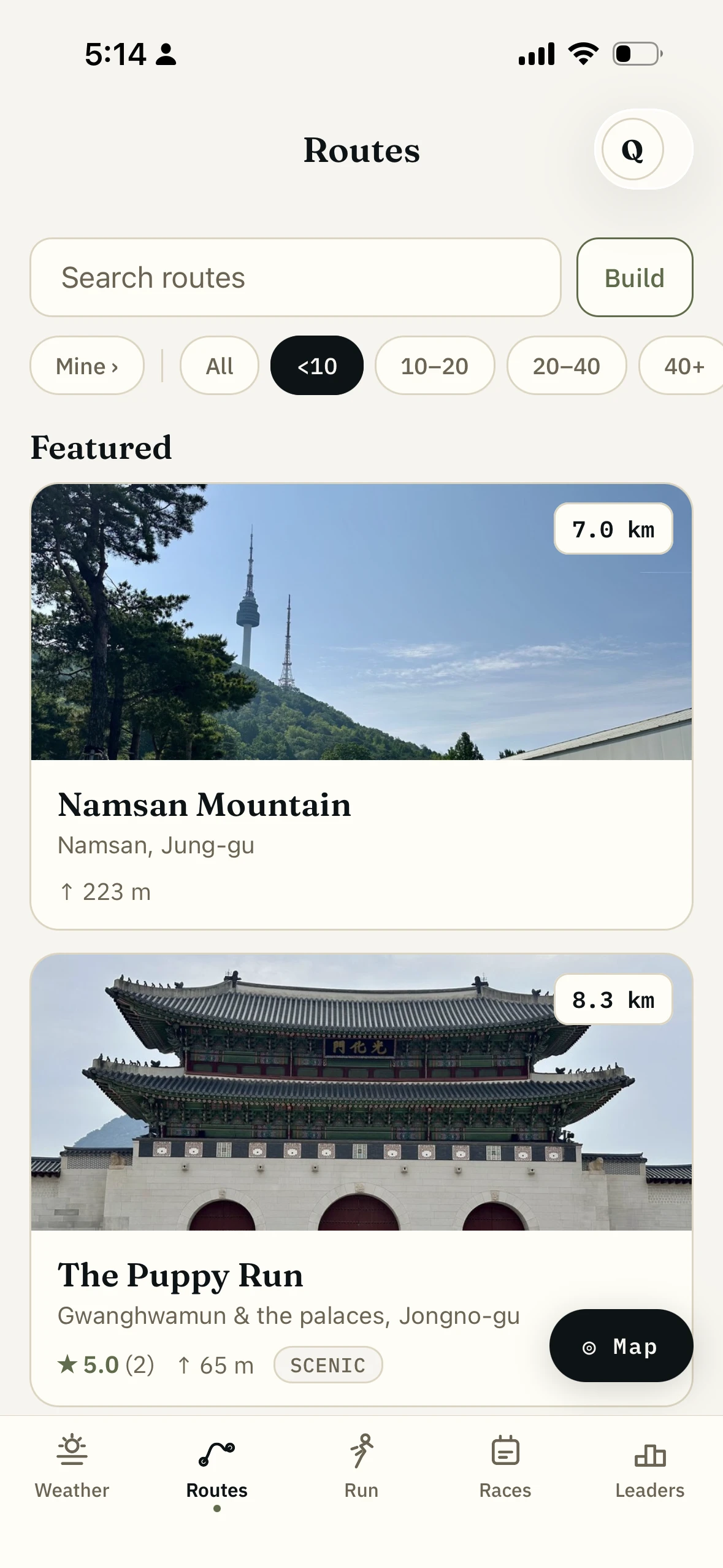
64 Seoul running routes on your phone, and the list keeps growing.
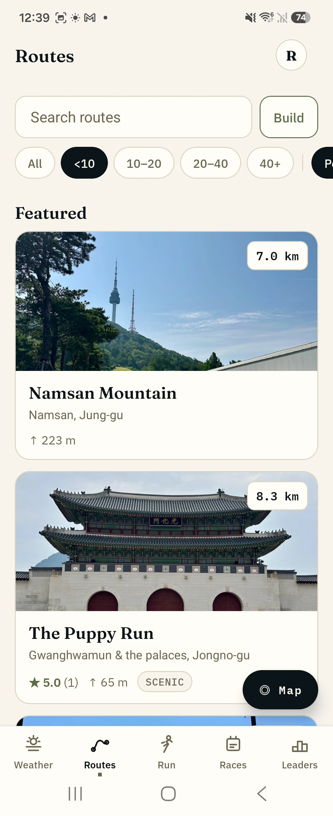
The Run With Me Seoul app carries 64 Seoul routes you can run turn by turn with no signal. The featured ones are my own, the routes I run every week and guide people on, down to which side of the bridge has the elevator. The rest are the broader set Seoul runners run most, found by how often people here save and repeat them.
Free. iOS and Android.
- 64
- routes and growing, across 52 areas of Seoul
- Mine + Seoul's
- the ones I run every week, plus the ones the city runs most
- 438
- water, toilet, store and station spots marked on them
How the routes work.
01
Pick by what you have got: distance, hills, or where you are.
Sort by what is near you, filter by distance or elevation, or see the whole city as lines on a map with the busier routes drawn heavier.
02
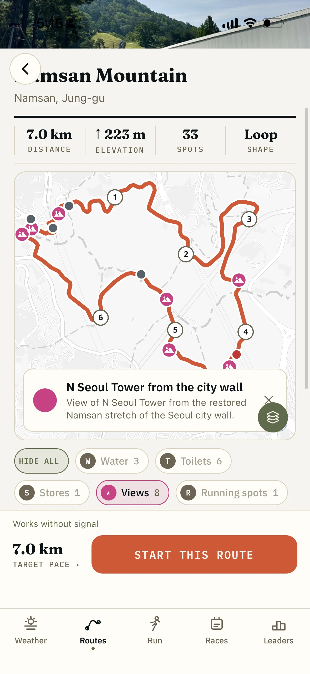
The featured six come with the parts you cannot see on a map.
Where to actually start, which side of the bridge to take, where the path floods, what the surface turns into. Those are the routes I run with people, written down.
03
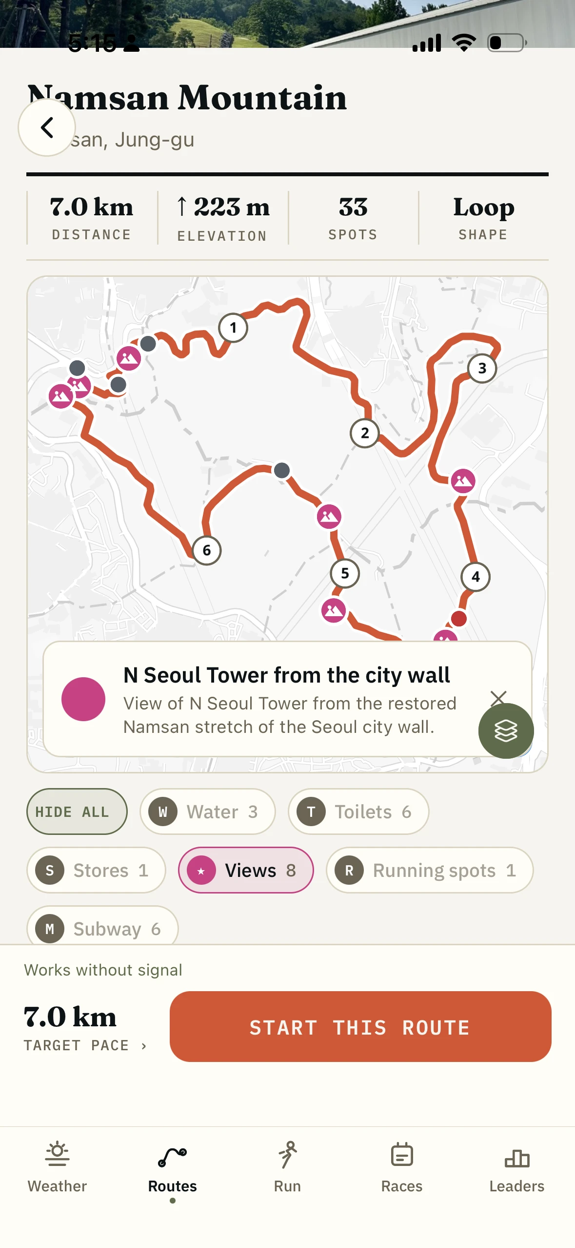
Water, toilets and a CU are already on the line.
Every route carries its own taps, toilets, convenience stores, cafés, viewpoints and subway exits, on toggles. You see what a 17K has on it before you commit to the 17K.
04
Download once and it works underground.
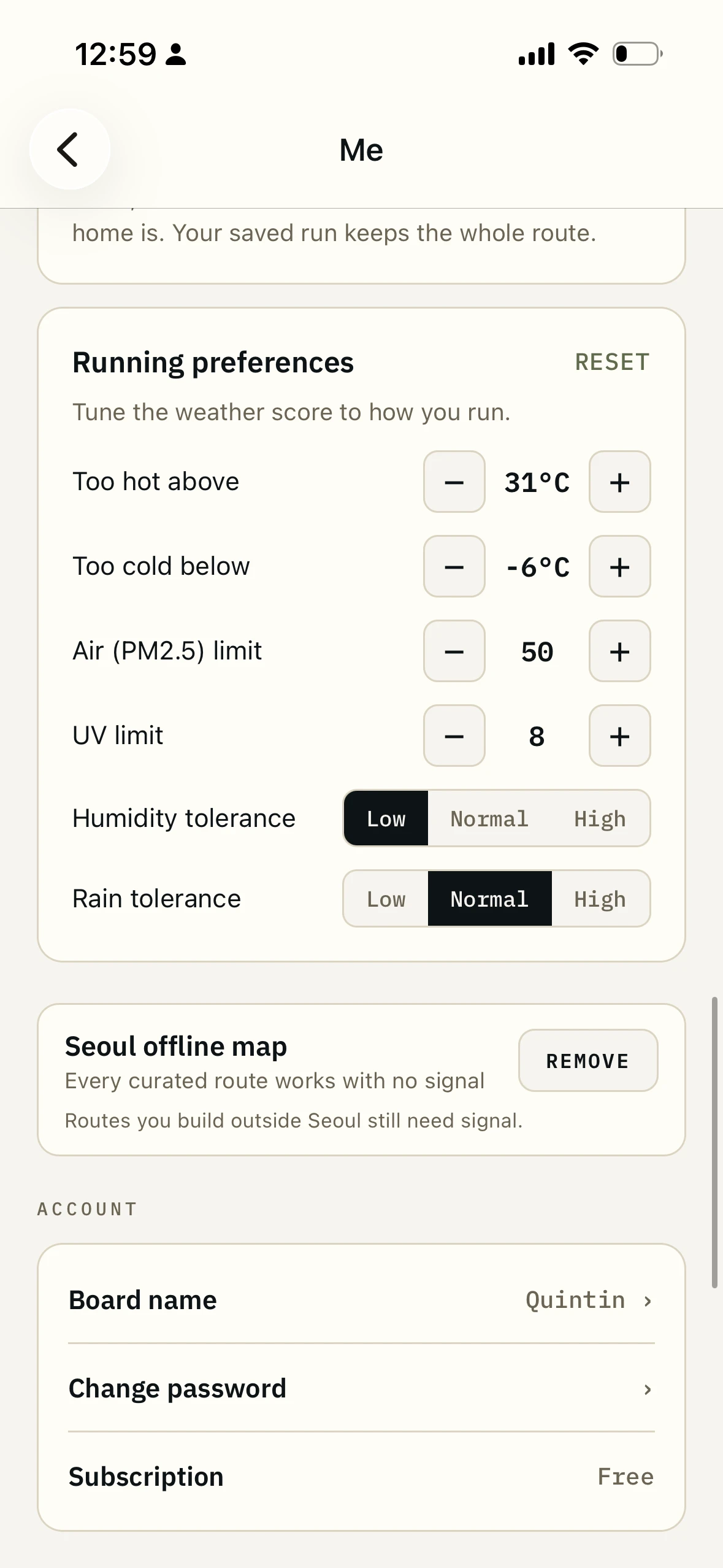
One map pack covers every route. After that the line, the pins and the turn-by-turn keep working in a tunnel, on a plane, or where the signal gives up.
What is in the route library.
- Routes
- 64, across 52 areas of Seoul and just outside it
- Where they come from
- The featured ones are mine, the ones I run every week. The rest are what Seoul runners run most
- Distances
- 4.1km to 209km, median 15.4km. 19 under 10K, 23 between 10K and a half, 22 half or longer
- On every route
- Distance, elevation gain, area, nearest station, and the amenities along it
- Marked places
- 438 spots: water, toilets, stores, cafés, views, subway exits
- Written notes
- 24 on the featured six, 28 across the catalogue, about the bits a line cannot tell you
- Turn-by-turn
- Yes, with spoken cues, in either direction
- Offline
- One map pack covers all of them, and no route falls outside it
- Export
- GPX, to a watch or another app
- Price
- Free
Every route in the catalogue, by distance.
Who it is for.
You have run the same out-and-back for six years.
I did that. I lived ten minutes from Seoul Noodle Park for six years without once running there, and it is now one of my favourite mornings in the city. The routes exist; finding them is the hard part.
You are visiting and have one morning.
One run near where you are staying, no wrong turns, no map-checking at every corner. Pick one the night before and follow it.
You just moved to a new neighbourhood.
You want a known-good run from your building before you have the confidence to invent one.
You are going long and need it to work at 25K.
Long routes carry their water. Twenty-two are half-marathon distance or longer, and you can see the taps before you start.
What it is not.
Two kinds of route, and the app says which.
The featured routes are mine: the ones I run every week and take people on. The rest are the broader set, in the app because a lot of Seoul runners run them, which is better evidence than one person's taste. The app keeps the two apart on screen so you always know which you are looking at.
It is not for the mountains.
Bukhansan and Gwanaksan are mapped unevenly, and a drawn line up a mountain can be wrong in ways that matter. Use a trail app and your own eyes up there.
It is not the reading version.
Photographs, what a route feels like, what is worth stopping for: that is the routes section of this website.
It is Seoul.
The recording, the builder and the map work anywhere. The routes, the amenities and the local knowledge are this city. That is the point of the name.
How it fits with the rest of the app.
- The routes on the web
The reading version: photographs, what each run feels like, a page per route.
- The route builder
A curated route is a line somebody checked. The builder is your line. Open one in the other and it becomes yours.
- Water, toilets and stores
Every route carries its own, counted before you start and named as you come up on them.
- Leaderboards
Boards belong to these routes. Run one properly and you are on it.
Questions.
Have you run all of these yourself?
The featured ones, dozens of times each. Those are the routes I run every week and guide people on. The rest are the broader set: they got in because Seoul runners run them often enough to show up in the data, and I am working through them.
How is this different from the routes on the website?
Same routes, different job. The website is for reading: photographs, what the run feels like, what is nearby. The app is for running: the line under your feet, the turns spoken, the taps marked, no signal needed.
Do they work offline?
Yes. Download the map pack once, from your profile, and the whole catalogue works with no signal. No route falls outside it.
How long are they?
From 4.1km to a 209km ultra line, median 15.4km. Nineteen are under 10K, twenty-three between 10K and a half, twenty-two a half or longer. Of those, fifteen sit between a half and 50K and seven are ultra lines.
Are there trail routes?
Yes, including the Seoul City Wall trail. For mountain running on Bukhansan or Gwanaksan, use a trail app instead.
Are new routes being added?
Yes, as they get tested. Recommendations come from friends and from runners here, and I run them before anything goes in.
Run somewhere you have never been.
64 Seoul routes, offline, turn by turn. Free, on iOS and Android.
The rest of the app.
- The route builderDraw a line, it snaps to runner paths
- Water, toilets and stores7,274 places on the map, no signal needed
- GPS run trackingRecords offline, follows your route, GPX in and out
- The running weather scoreOne number for whether to run right now
- Leaderboards and friendsWhole routes, not segments, among people you know
- The Korea race calendar400+ races, with an alarm before entries open